The ReUseX Solution
AI-powered resource mapping from LiDAR — circularity-ready 3D models and inventories for faster transformation decisions. ReUseX standardises how existing buildings are captured, structured, and shared, so teams can evaluate reuse potential early and document decisions with confidence. Because the workflow and outputs are standardised, ReUseX is designed to scale from single buildings to portfolios.
3D Scanning
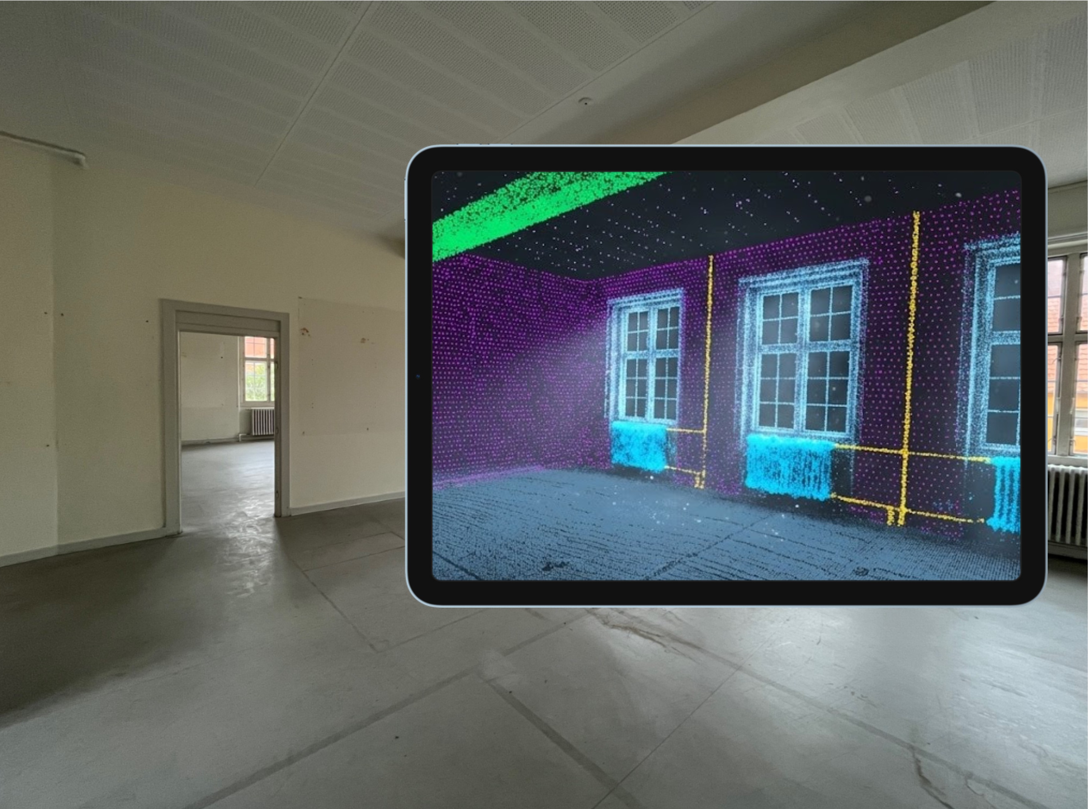
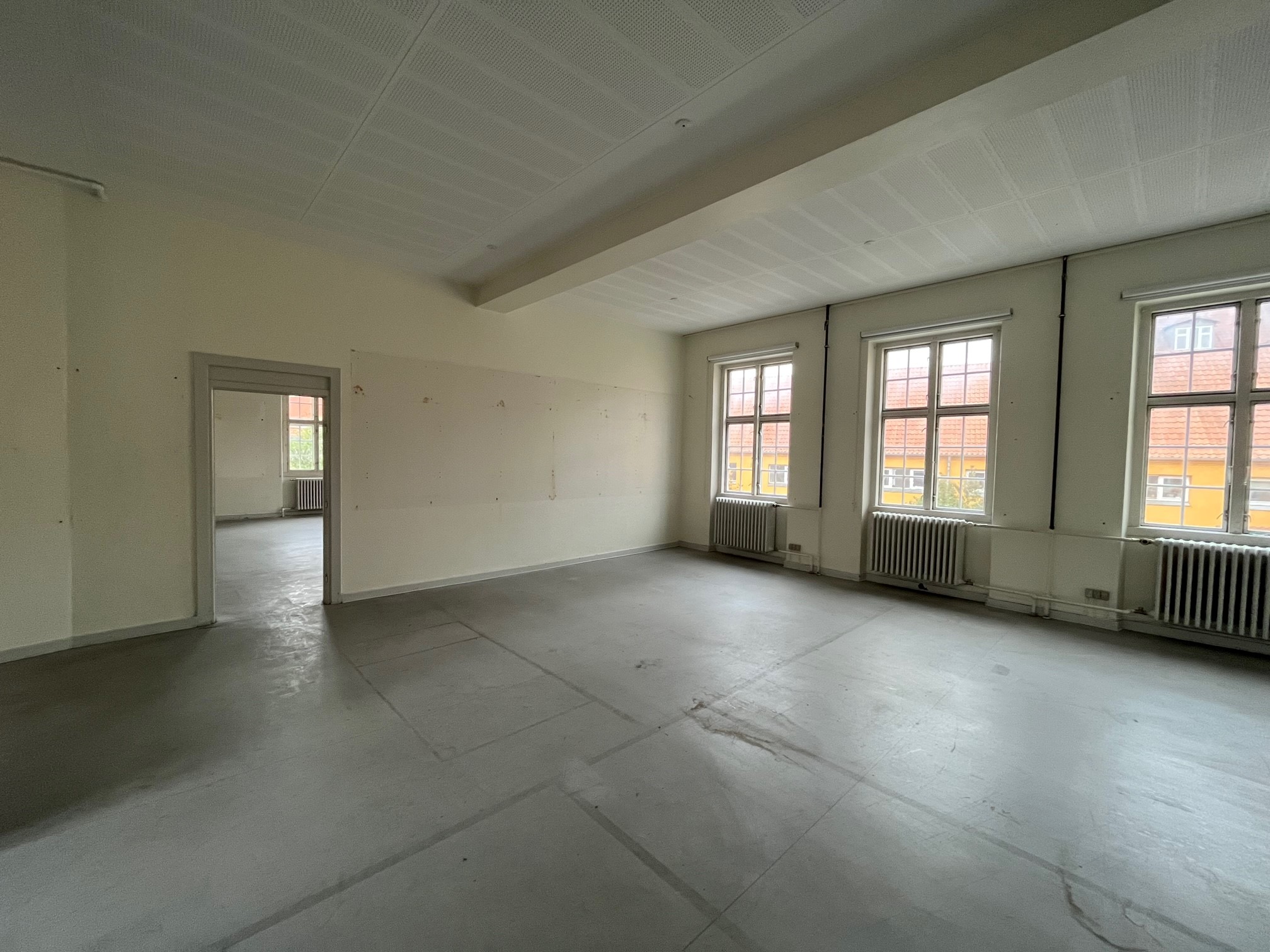
Reliable decisions start with reliable capture. ReUseX combines LiDAR scanning and 360° imagery to create a consistent digital record of the existing building—fast, repeatable, and suitable for early-phase analysis.
AI-powered resource mapping
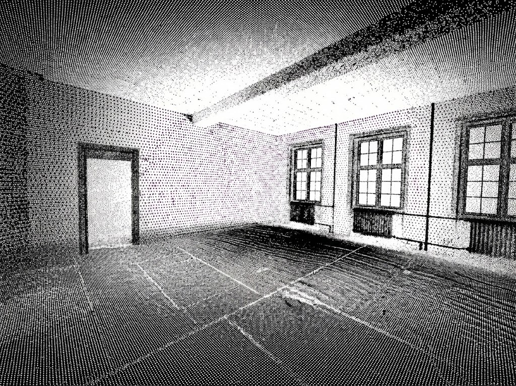
We capture the building geometry as a scan-based dataset that represents what is actually on site—not what an outdated drawing says. 360° imagery adds visual context that supports interpretation, review, and quality control. The result is a robust input for downstream processing: registration, point cloud generation, segmentation, and model creation.
What you get
- A capture workflow that works on real existing buildings
- Scan + imagery packaged for processing and traceability
- A consistent starting point for transformation and reuse screening
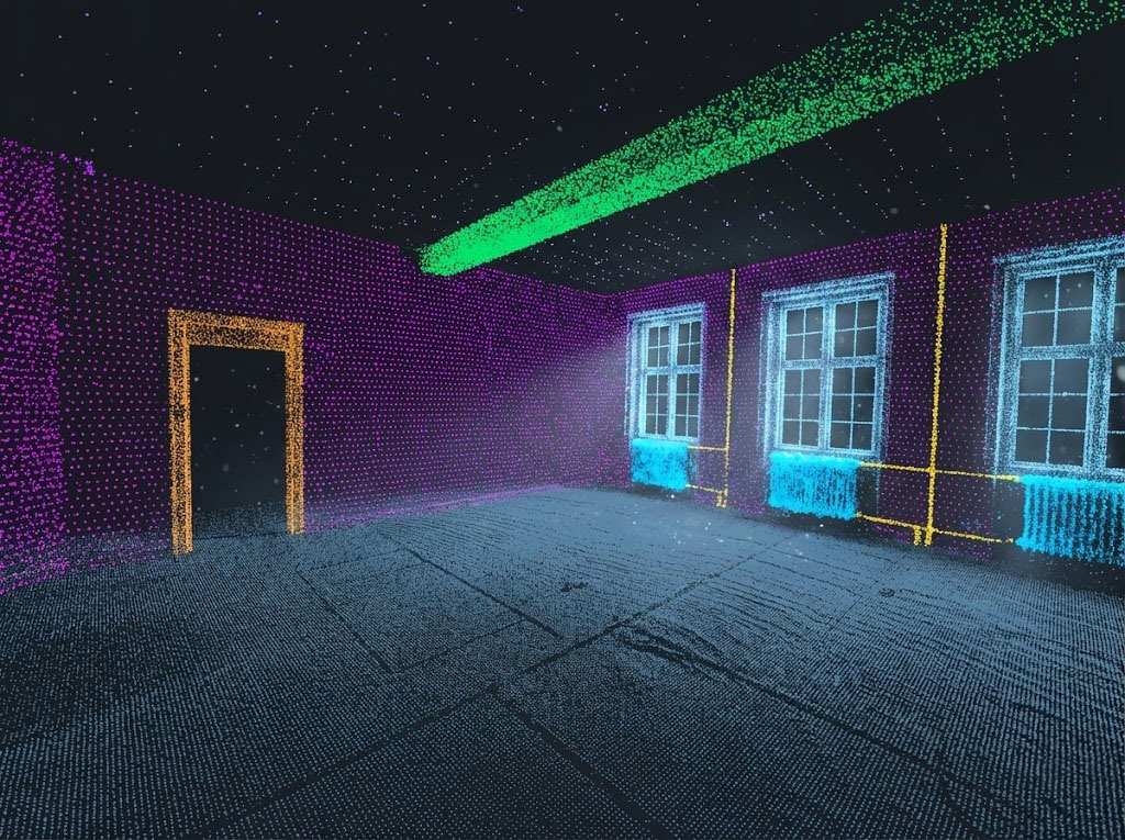
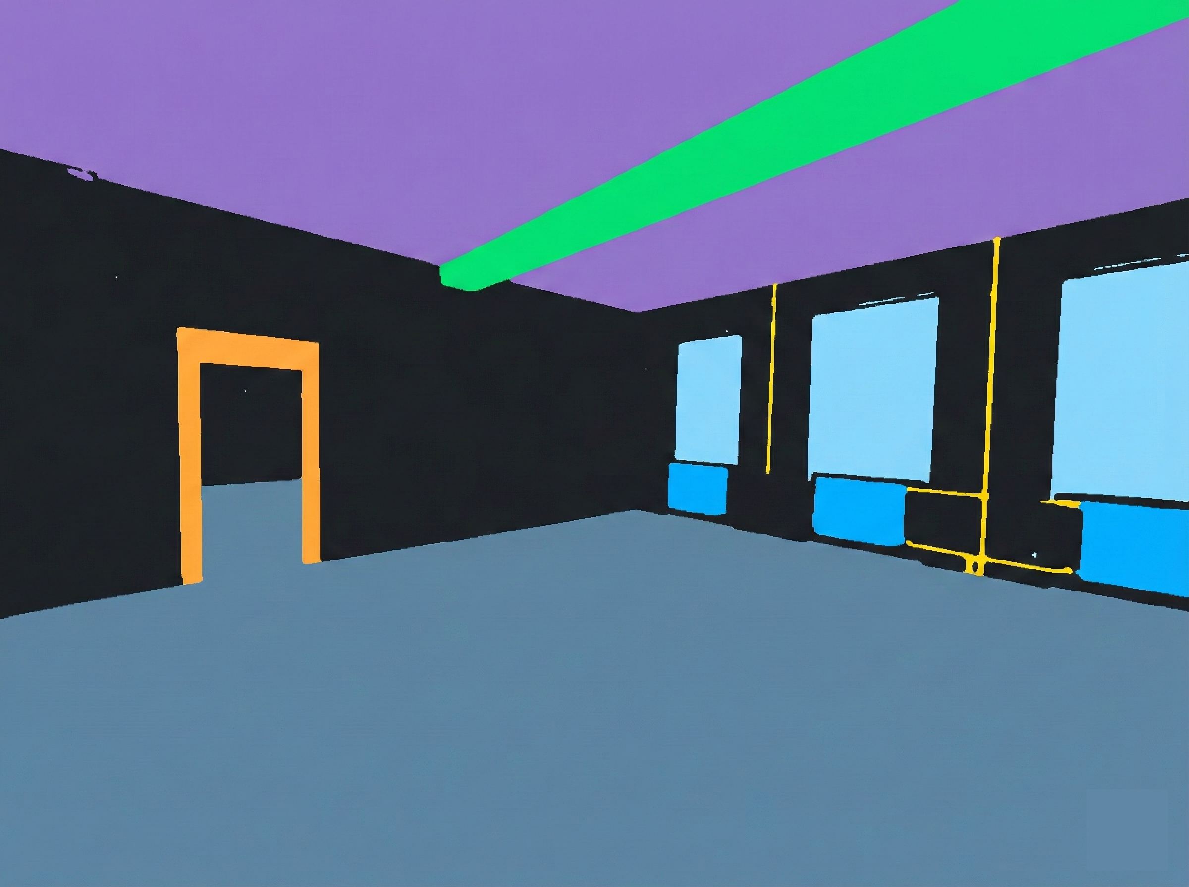
AI based Segmentation
ReUseX uses AI to turn raw point clouds into structured building information—identifying components and organising them into a simple, analysis-ready 3D model and inventory.
From scan to 3D model
After upload, ReUseX generates a unified point cloud and produces a simplified 3D model designed for early decision-making. This model is not a full as-built BIM replacement—it is a lightweight, structured representation that supports screening, quantities, and collaboration.
AI-powered resource mapping
ReUseX segments the point cloud into building elements and systems (for example structural and envelope components). The segmentation is designed to support reuse evaluation: locating components, understanding extent, and preparing structured datasets that can be reviewed and refined.
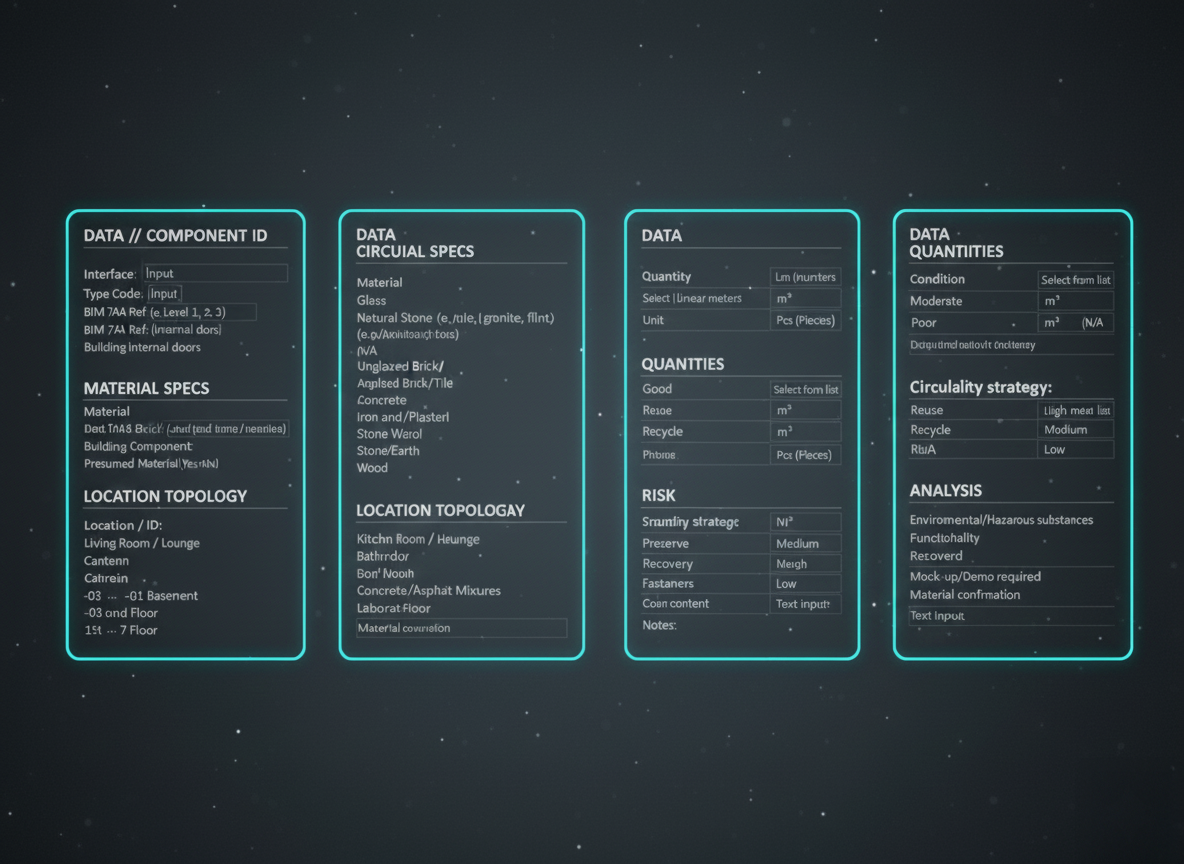
Reuse inventories & exports
From the segmented dataset, ReUseX produces structured inventories and geometry exports. These outputs are designed to integrate with common AEC workflows—BIM coordination, spreadsheets, LCA/circularity assessments, and feasibility studies—so your team can move faster from 'capture' to 'decision'.
What you get
- Segmented point cloud organised by component categories
- Simplified 3D model aligned with the inventory structure
- Exports for 3D/spreadsheets/analysis tools
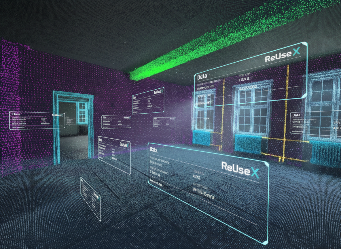
Cloudbased Platform
All outputs are connected in one place. ReUseX provides a shared 3D workspace where geometry, inventories, documents, and analysis results stay aligned— so stakeholders collaborate on the same dataset.
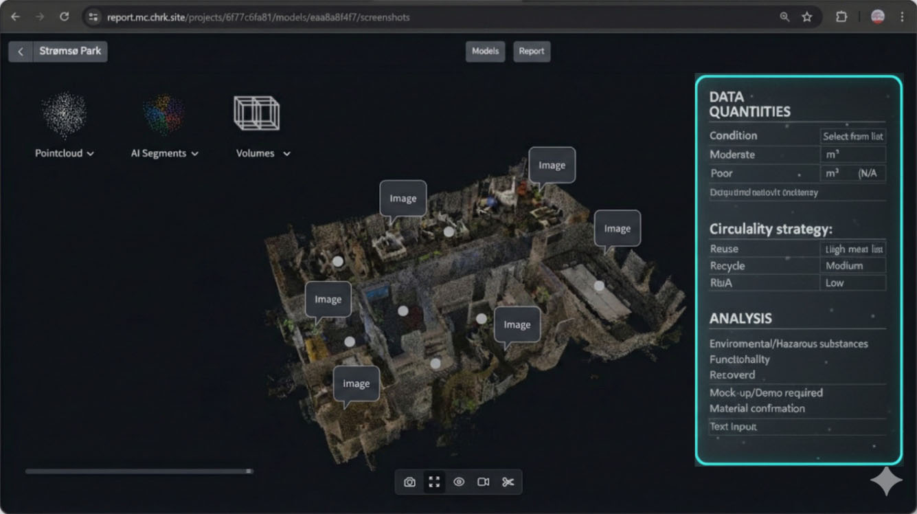
Explore reuse potential in an interactive 3D dashboard
The ReUseX platform links the building's 3D view with structured component data and supporting documentation. Users can navigate by location and component type, inspect key elements, and use the platform as a common reference during early-stage workshops and decision gates.
Platform capabilities
- Inspect the building in 3D with components highlighted and searchable
- Open inventories, documents, and analysis outputs directly from the model
- Share one consistent view across owners, architects, engineers, and consultants
- Track updates and maintain traceability from input data to deliverables
What you get
- A structured building dataset ready to use across teams
- Consistent documentation that supports handover and approvals
- Decision-ready deliverables for early transformation and reuse screening